Projects
1. 2D Inversion of Marine Magnetotelluric Data from the Northern Gulf of California
One of the most exciting experiences during my master’s studies was participating in a groundbreaking geothermal exploration project funded by the Mexican Government.
The survey took place in the northern Gulf of California, a region with immense geothermal potential. I had the opportunity to work hands-on in acquiring marine magnetotelluric data—a fascinating process that blends geophysics. My role didn’t stop there; I dove into time-series processing, performed 2D inversions, and integrated heat flow and seismic data to uncover valuable insights about the subsurface. Seeing this work come to life in a publication was incredibly rewarding: https://doi.org/10.1016/j.jsames.2020.102501.
What made this project even more inspiring was the collaboration between world-class institutions: the Scripps Institution of Oceanography in San Diego, California, where I honed my skills in advanced data processing, and CICESE, a leading research center in Baja California. Working alongside experts from both organizations deepened my passion for geophysics and strengthened my commitment to contributing to renewable energy research.
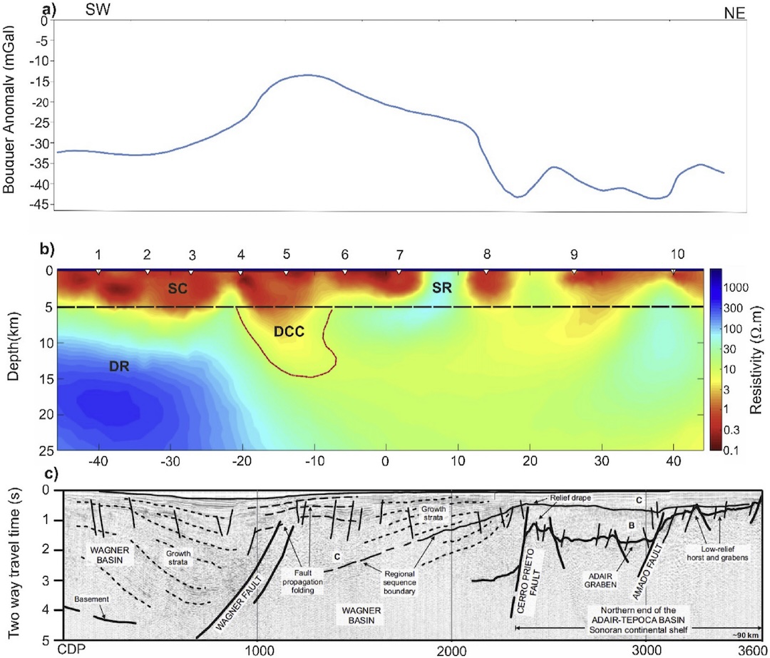
Figure 1: Bouguer gravity anomaly (mGal) from Pérez (1982). b) 2D model estimated by the inversion of the MT data. The rms misfit error is 1.7. The main resistivity features are indicated: shallow conductor (SC), shallow resistor (SR), deep resistor (DR), and deep central conductor (DCC). The red outline around the DCC structure denotes the perturbed area in the sensitivity test. c) Structural interpretation from a seismic profile close to our MT line (Aragón Arreola, 2006). Vertical axis is two way travel time. The approximate depth range covered by this seismic section is indicated by the dashed line of the section in b).
2. GeMEX Project: World Cooperation in Geothermal Research
The GeMEX project was a collaboration between Europe and Mexico focused on developing Enhanced Geothermal Systems (EGS) and Superhot Geothermal Systems. It ran from 2017 to 2020.
During this project, seismic, gravity, and electromagnetic studies were conducted, among others. I was part of the electromagnetic exploration team, where we collected transient electromagnetic (TEM) and magnetotelluric (MT) data in the Los Humeros and Acolculco geothermal fields in Mexico.
Later, I worked on the robust processing of time series data and its inversion. In a later stage, I actively participated in interdisciplinary meetings where we discussed results from various geophysical studies.
One of the most valuable lessons I learned was the importance of integrating data into maps, which speeds up the process of bringing information together for everyone involved. I also met one of the group leaders, whose combination of strong scientific rigor and human-centered leadership deeply inspired me. Her ability to manage teams effectively left a lasting impression on me.
I also gained experience presenting results in English and learned how to work efficiently under strict deadlines while maintaining scientific accuracy.
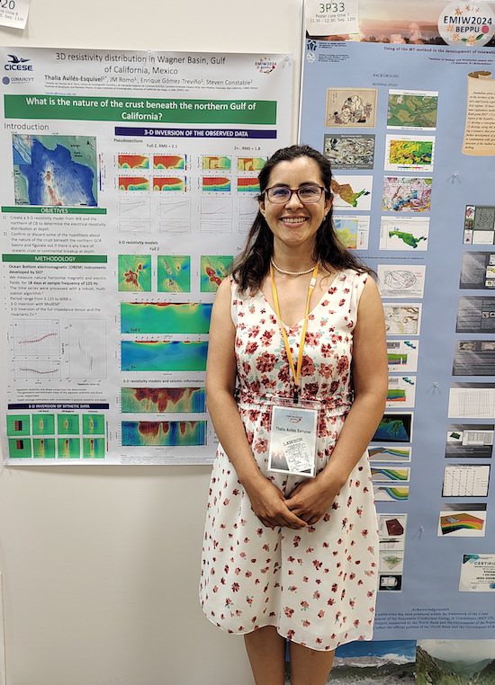
3. 3D Marine Magnetotelluric Inversion at the Gulf of California
Most marine magnetotelluric (MT) studies have been conducted using 2D algorithms. In some datasets, though, clear 3D effects from subsurface structures appear, which 2D algorithms struggle to capture properly.
One of the main challenges in 3D inversion of marine MT data is accurately modeling the complexity of bathymetry while keeping the process computationally feasible.
In this project, we used data from the Wagner Basin and applied the ModEM inversion algorithm. After a thorough analysis, the results revealed a conductive zone below 10 km depth, located in the transition between the Wagner and Consag basins. This study is important as it improves the understanding of the crustal state in this region.
Preliminary results have been presented in internal talks and recently at EMIW-24 in Beppu, Japan.
The findings from this research are currently in the process of being published. Further work will focus on refining the resolution of the conductive anomaly and comparing the results with other geophysical methods, such as seismic and gravity data, to better constrain the geological interpretation.
4. Electric data
Landslides reshape landscapes and, in urban settings, can devastate entire communities. After an unusually intense rainy season in Tijuana, Mexico, in 2017, 16 houses suffered severe damage due to major landslides. This event raised urgent questions about what triggered such destruction.
Motivated by the need to understand the underlying causes, a research team of geologists and geophysicists launched an in-depth investigation, and I had the opportunity to contribute by acquiring and processing three geoelectric profiles. The findings were striking—our data revealed a strong correlation between conductive subsurface materials, mainly silt and clay. When saturated with water, these materials behave plastically, significantly increasing the risk of slope failure (Delgado et al., 2019).
Being part of this project reinforced my appreciation for the critical role of soil studies before any construction begins. Proper geological assessments can prevent disasters that not only destroy homes but also impact families' lives in profound ways.
The research is published by Delgado et al. (2019) and is available at: Read the full study.
5. Kilo Moana
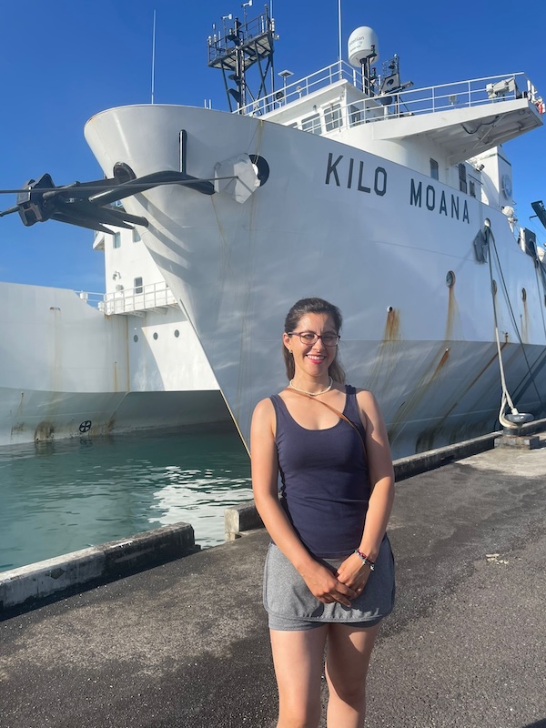
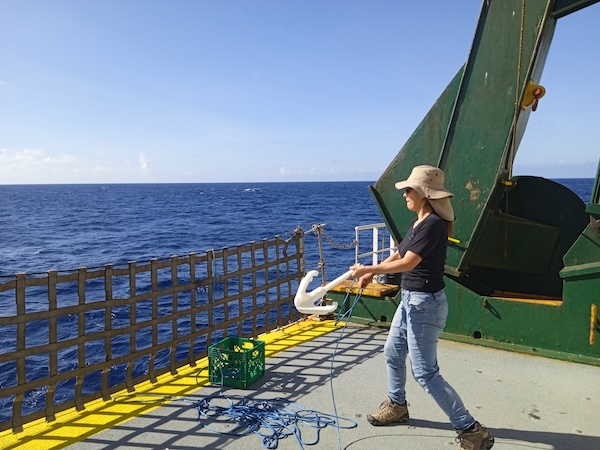
In 2024, the Scripps Institution of Oceanography launched an expedition to nearly the exact center of the Pacific Ocean to gather MT, sonar, and magnetic data. The goal was to uncover more about the tectonic processes shaping this vast and remote region of the planet’s largest ocean. I was lucky enough to be one of just seven students selected from 42 applicants. Even more special, I was the only Latina studying in Latin America, while the rest of my colleagues came from universities in the U.S.
During the expedition, I learned how to calibrate the MT equipment and even assisted in calibrating some of the instruments used for data collection. I played a role in acquiring MT data, gave presentations on electromagnetic methods to my colleagues and technicians, explored magnetic data, and helped troubleshoot challenges we faced along the way. Every day brought something new—whether it was redefining our routes, tackling unexpected technical issues, or simply sharing unforgettable moments with my team.
One of the most memorable traditions we took part in was making an offering to Neptune when we crossed the equator. Let’s just say, the ceremony was both entertaining and well received by the god of the sea.
As for the cornhole competition... our team gave a truly spectacular performance—one of the best at not making it to the final rounds.
Some fun facts from this adventure:
- We spent 28 days at sea without seeing a single plane or ship.
- It wasn’t until day 35 that we finally spotted an island—it was just us and the ocean.
- The food on board was incredible. Every meal was delicious, and sometimes we even got to enjoy fresh tuna and squid caught by a crew member who generously shared his catch.
- The captain and crew were welcoming and always made sure we were safe, productive, and happy on board.
Looking back, this expedition was one of the most enriching experiences of my life, both professionally and personally. Being surrounded by the ocean, learning so much, and sharing this journey with an amazing group of people was unforgettable. I absolutely loved every part of it!
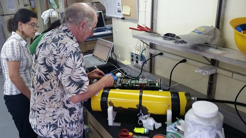
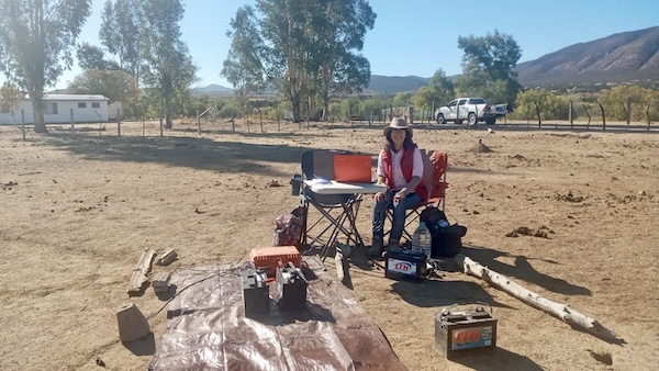
6. Laguna salada
During my Doctoral studies, I had the incredible opportunity to take part in the MT data acquisition campaign in Laguna Salada, a key project contributing to my colleague’s Doctoral thesis. This experience was especially meaningful to me because I not only applied my expertise in the field but also played an active role in mentoring others.
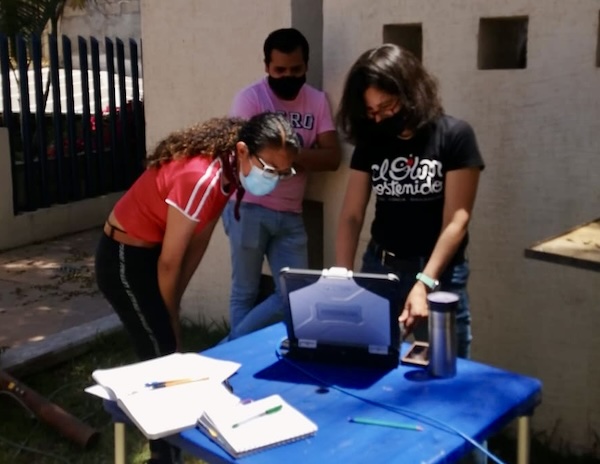
My main responsibilities included teaching Carolina (picture above) how to operate the MT measurement instrument and sharing the best field practices I had learned to ensure high-quality data acquisition. I also took charge of setting up and collecting data at the remote station, where I guided another colleague through the process of setting up an MT instrument and processing field data to assess its quality in real-time.
Being able to contribute my knowledge, help my colleagues develop their skills, and witness their progress has been deeply fulfilling. I’m especially proud to have played a part in this campaign, and I’m looking forward to celebrating my colleague’s graduation soon!
7. Teaching
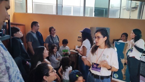
I really like a quote from a radio host who says, "And remember, what you know... share knowledge." This idea has always stayed with me. I believe that sharing knowledge is one of the most valuable things we can do. In my case, I have focused on science communication, teaching classes, giving conferences, and supporting colleagues. Recently, I even collaborated with a friend to bring more science content to her social media, which was a very exciting project for me.
Throughout my career, I have been lucky to participate in many science outreach events. At the beginning, I helped as staff, learning how everything worked behind the scenes. Later, I started to give talks myself, and not long ago, I had the opportunity to organize one of these talks. I have experience speaking to different types of audiences, like children, teenagers, and adults, and I enjoy the challenge of adapting my message to each group.
Some moments were especially meaningful to me. In 2024, I gave guidance to elementary school students in San Diego for their science project, which reminded me how curious and creative young minds can be. Then, in April 2025, I was invited to speak about electromagnetic methods to undergraduate students at the Benemérita Universidad Autónoma de Puebla. These experiences have motivated me even more to keep studying and improving my communication skills.
Sharing knowledge always makes me feel more responsible for the quality of my work. It pushes me to keep learning and growing. I am very grateful for the trust and time that people give me when they listen. Every time I share something, I truly hope that it helps or inspires them. I believe that using my abilities and strengths for the good of the community is one of the best ways to contribute to a better world.
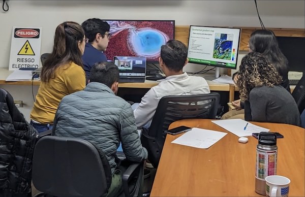
8. Geothermal Resource Exploration Contest by SEG-EVOLVE
SEG-EVOLVE is a mentor-guided virtual internship where students from different disciplines collaborate in teams to explore subsurface energy resources.
Right now, I am part of a team of eight students working on a geothermal prospect in Australia. Our group includes geologists, petrophysicists, and heat flow specialists. I am in the geophysics subgroup, where we are applying the magnetotelluric (MT) method to help describe the study area.
Each week, we meet as a team to discuss progress, challenges, and how we can integrate different datasets. We explore how each method contributes to a bigger picture and how one dataset can expand the understanding of another. MT is particularly useful because it provides insights at greater depths than seismic methods. We also expect it to help narrow down the geothermal source.
Every week, we present updates to our mentors and receive feedback. This experience has been incredibly valuable for me—not just technically but also in soft skills like teamwork, communication, and explaining MT to non-experts. I am also learning from other earth science fields as we work toward a shared goal. In the end, we aim to integrate geology, geophysics, and petrophysics to deliver a business plan.